Thank you for participating!
View the Final SLR Vulnerability Assessment: Click Here
View the SLR Maps: Click Here


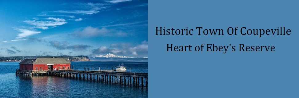
The Project
As a result of sea level rise, Puget Sound shores will be subjected to changes in the magnitude and frequency of coastal flooding. Many coastal communities are seeking to understand the potential risk that sea level rise poses to the things that they care about and taking steps to mitigate those risks.
With funding from the Department of Ecology’s Shoreline Competitive Grant Program, the Town of Coupeville is taking important steps to prepare for the effects of sea level rise by conducting a sea level rise vulnerability assessment. This assessment will evaluate which of the Town’s areas or assets are considered most at risk from sea level rise-related hazards.
Town staff have hired a consultant team to assist with community engagement and the technical analysis. The team is led by Peak Sustainability Group, with subconsultant Coastal Geologic Services conducting the technical analysis. The project began in earnest in summer 2022 and is expected to conclude during spring 2023.

What is Sea Level Rise?
Global sea level rise is primarily caused by the melting of glaciers and polar ice sheets and the thermal expansion of the oceans resulting from a warming atmosphere. The term “relative sea level rise” refers to the height of the ocean relative to the land at a specific location. Relative sea level rise is influenced by localized processes including vertical land motion, postglacial rebound, and the temperature and circulation of the ocean. Because of the localized variability of these processes, relative sea level rise and its impacts will vary from place to place.
Ultimately, rising seas will inundate low-lying coastal lands and islands. This inundation will intensify erosion and flooding as more coastal area is exposed to storm surges, waves, currents, and tides. These impacts pose a threat to human health, coastal property and infrastructure, and coastal ecosystems.
Sea level rise is happening now and is expected to accelerate in the coming decades. Smart coastal communities will begin to plan for and adapt to the impacts of rising seas now.
While rising seas are inevitable, the extent of sea level rise will largely depend on the rate and severity of climate change. Communities can help mitigate climate change and its impacts by reducing the quantity and rate of greenhouse gases emitted into the atmosphere.
See the draft assessment and sea level rise vulnerability maps today! These maps are for review only. An updated draft and an opportunity for public comment will be available this spring.

What is the Sea Level Rise Vulnerability Assessment?
The sea level rise vulnerability assessment will identify which areas of Coupeville are exposed to future flooding and erosion associated with sea level rise, and what the consequences might be of that exposure to existing infrastructure.
The assessment includes a spatial, GIS (Geographic Information Systems)-based analysis to identify areas along the shore that are susceptible to coastal flooding.
The analysis will include:
- Identification of the impacts and consequences of sea level rise;
- Assessment of Coupeville’s physical characteristics to determine which assets are exposed to coastal flooding and erosion, exacerbated by sea level rise;
- Consideration of the ability of those assets or systems to adapt to the impacts of sea level rise;
- Development of a range of plausible sea level rise scenarios;
- Identification and ranking of focus areas; and
- A summarization of the vulnerability of Coupeville’s various assets.
This analysis will consider assets such as the wastewater treatment plant, roads, and outfalls within the Town of Coupeville that may be exposed to coastal flooding or erosion by 2100.
Review the Sea Level Rise Methodology and Timeline Summary to learn more about the project.
Schedule
July 2022: Project commenced
January 30, 2023: Draft vulnerability assessment available
January 30 – February 25, 2023: Survey open to the community
February 1, 2023: Sea Level Rise Vulnerability Technical Assessment Presentation
February 9, 2023: Virtual Public Event
- 6:00pm – 7:30 pm | Thank you for attending!
- Video Recording
March 2023: Draft sea level rise vulnerability assessment completed
April 2023: Final sea level rise vulnerability assessment completed
- To view the Final SLR Vulnerability Assessment: Click Here
- To view the SLR Maps: Click Here
Thank You for Getting Involved!
Thank you for completing the Sea Level Rise and Coupeville Survey! Your survey responses helped inform our Final Vulnerability Assessment! To view the Town’s Engagement Summary Report: Click Here
Thank you for attending our virtual public meeting on Thursday, February 9, 2023 from 6 – 7:30 PM! We appreciate you taking the time to learn about the preliminary results of the sea level rise assessment and share your input to help guide the next phase of the project.
If you have questions about this project, please contact:
Joshua Engelbrecht, Assistant Planner
(360) 678-4461 ext. 104
assistantplanner@townofcoupeville.org
Sea Level Rise Resources
- Environmental Protection Agency (EPA) – Sea Level Rise:
- Miller et al. (2018). “Sea Level Rise Projections for Washington.”:
- National Oceanic and Atmospheric Administration (NOAA) – Sea Level Rise Viewer:
- US Climate Resilience Toolkit – Sea Level Rise:
- WA Department of Ecology – Sea Level Rise in Washington: